Cartography: The Science of Mapmaking
July 24th is National Amelia Earhart Day. This is a day to remember and honor a brave woman and accomplished aviator who had a yearning for exploration and flight. In 1928, Amelia Earhart was the first woman to fly across the Atlantic Ocean, She navigated a plane called “Friendship” and rode along with two other pilots. In 1932, she successfully flew across the Atlantic Ocean again, but this time, she did it alone. Her next goal was to fly across the entire world, and in 1937, she and flight navigator Fred Noonan made it all the way to New Guinea in the South Pacific. Unfortunately, their plane went down in the Pacific Ocean somewhere near Howland Island so she was unable to accomplish her goal of world flight. Amelia Earhart will always be remembered as a woman who was a forward thinker with a thirst for exploration and adventure.
Click to watch an animated video biography about Amelia Earhart.

Amelia Earhart in 1937. (Image credit: Underwood & Underwood / Wikimedia Commons)
Exploration and Mapping
The search for adventure and exploration is inside many of us, and has been part of human history for thousands of years. Ancient people used boats, horses, or their own feet to explore. Today, we use high-tech devices such as airplanes, submarines, and rockets to explore the world and beyond.
The one thing that we modern people of today have in common with ancient people is that we record and track our exploration in the form of maps. Maps have been around for thousands of years. The word cartography is used to explain the study and process of making maps. It comes from the Greek words chartes (“sheet of paper”), and graphein (“to write”). Map makers are called cartographers.

The top image is a world map by the Amsterdam-based cartographer Gerard van Schagen in 1689. The bottom image is a world map from the 2016 CIA World Factbook (Image credits from top to bottom: Gerard van Schagen / Wikimedia Commons; US Government (CIA) / Wikimedia Commons)
There are many kinds of maps that can help a map reader discover something. Some examples are below.
Political maps show national and international borders as well as city locations.
Physical maps will show physical features of a location such as lakes, rivers, mountains, or forests.
Topographic maps are similar to physical maps except they focus on displaying differences in elevation (how high an area is).
Climatic maps can show the different climates of an area such as rainfall, snow, or dry weather.
Road maps are useful when people need to find out how to drive somewhere. Most people have GPS navigation in their car or on their phone, but it is still helpful to know how to read a road map in case of emergencies.
Thematic maps are maps that have a certain theme to them. An example would be a map of the United States displaying the different climate zones that will help gardeners choose when to plant and what types of vegetables to plant based on where they live.
Features of a Map
Not all maps are the same, but most maps that display a location have similar features or elements. Let’s find out what types of basic features a map should have in order for someone to successfully read it.
Title - the title of a map will tell the reader what the map is showing. Title examples could include: “A Map of New Hampshire Rivers” or “A Street Map of Concord, New Hampshire”.
Legend - a map should always have a legend if there are symbols on the map that represent things such as trees, roads, mountains, or buildings. The legend, sometimes called a key, will tell you what each symbol means.
Grid - the grids are lines that go across the map from left to right and from top to bottom. These lines mark the latitude and longitude. The latitude lines run from west to east, or alongside the equator (the imaginary line that lies halfway between the North Pole and the South Pole). The longitude lines run from north to south (top to bottom).
Direction - also called orientation, the direction is normally in the form of a compass rose that shows which direction points north. Most maps will have north pointing towards the top of the map.
Scale - it is helpful to know how big of an area the map is showing in relation to a measurement in real life. For example, a scale could tell you that one inch equals one mile on your map. With that information, you would be able to see how far away two or more locations on your map are from each other.

Certain features, such as a title and legend, will help someone better understand the map they are looking at. (Image credit: Jeshoots.com / Unsplash)
How to Read and Use a Compass
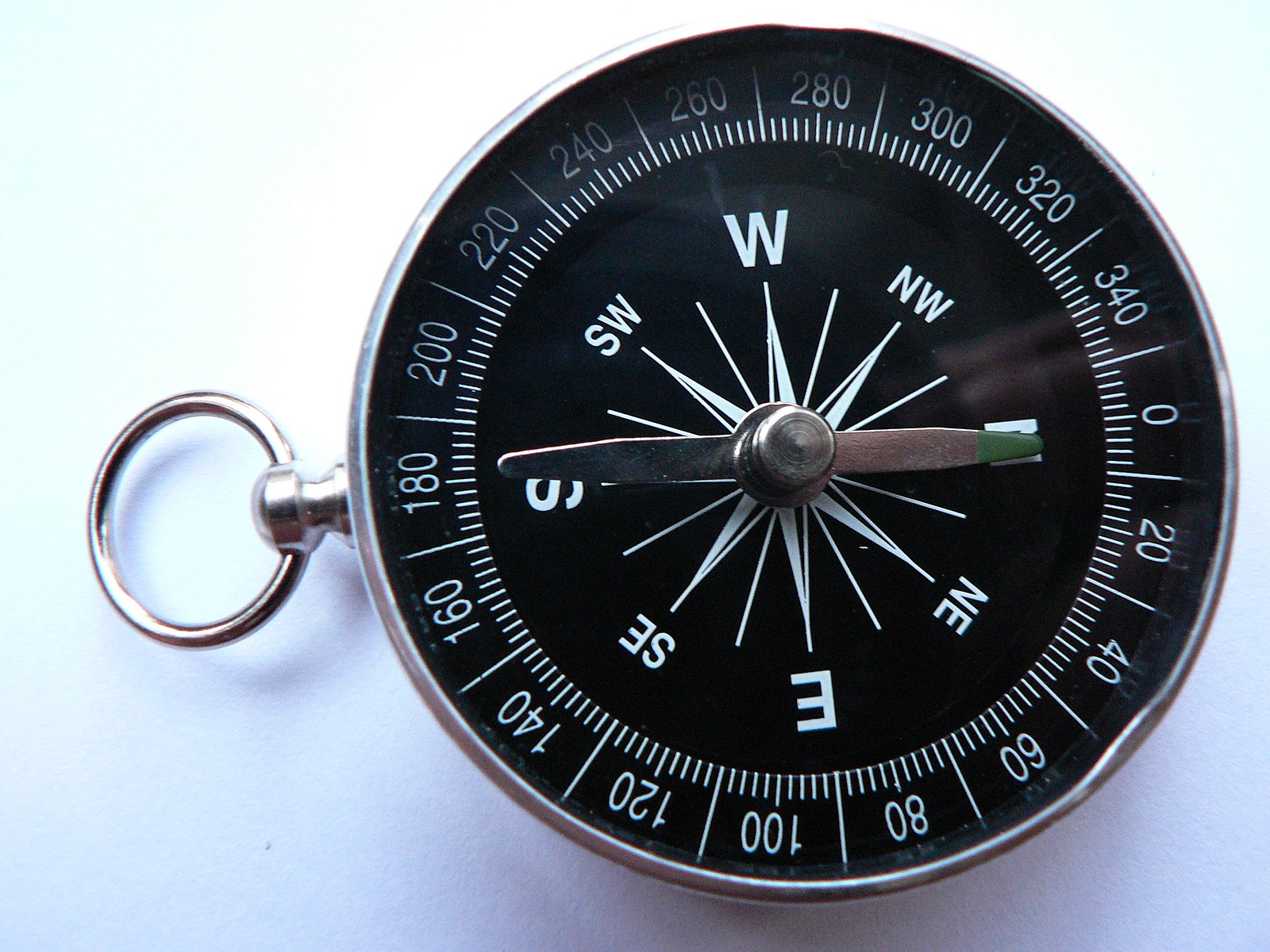
A simple magnetic compass. The green-colored part of the arrow/needle is pointing north. (Image credit: Bios / Wikimedia Commons)
A map usually goes hand in hand with a compass, so it is helpful to know how to read one. A compass is normally a handheld device that one uses to see which direction is north. This is done by viewing a small arrow on the compass that always points north. It does this by detecting the Earth’s magnetic field using a built-in magnetized needle. Magnetic compasses have been around for over 2000 years and are still used today. Smartphones can also become compasses when special sensors inside the phone are activated while using a compass application.
The four directions on a compass in relation to let’s say, a typical world map, are in the order of north, east, south, and west. If you can’t remember the order in which these directions are shown on a compass, it’s sometimes helpful to come up with what’s called a mnemonic: a memory device that allows you to remember something. You can recite a memorable sentence to remember the “north, east, south, west” order such as “Never Eat Slimy Worms”.
Learn how to make your own compass using household items.
Find The Explorer in You
The idea of exploring an unknown place can be exciting for most people. Take some time to think about if exploration excites you and if so, think about where you would like to explore someday.
Maybe you just want to start small and take a walk down a street near your home that you’ve never been down before.
You could be interested in exploring the bustling sidewalks of the closest city to you.
You might even want to venture out to another state or even a different country.
Maybe someday you’d like to fly your own aircraft to explore the world like Amelia Earhart did.
The sky is not even the limit for you if you’d like to become an astronaut and explore space.

Image credit: Chris Lawton / Unsplash
If you ever want to do these things, it’s a good idea to learn how to read a map and a compass and you’ll be well on your way to becoming an accomplished explorer!
Want More Maps?
Visit the following websites:
NASA Worldview - explore maps of Earth from a satellite’s point of view.
NASA Earth Observatory - view themed global maps ranging from chlorophyll levels in the oceans to sea surface temperatures.
NOAA National Weather Service - view maps of the weather forecast anywhere in the country.
NH Stonewall Mapper - check out a map of our very own New Hampshire that shows locations of old stone walls that were placed hundreds of years ago. The stone walls were discovered and mapped using a technology called LiDAR.
Google Earth - the world is literally at your fingertips; explore any location on Earth by searching or clicking and zooming in on a 3D globe.
By Megan Goldsmith